This blog is based on the CII-ACWADAM-ITC Basin Scale Study, for Enabling Sustainable Management of Water Resources, Agricultural Livelihoods and Allocations to other uses such as Industrial and Domestic Uses : Case Study of Ghod River Basin, District Pune
By Special Projects Department, Confederation of Indian Industry
and acknowledges the field, analytical, and GIS work that underpins the findings.
All methodological details, ETo ranges, Kc tables, and ETa–yield relationships are cited directly from the study’s datasets and documentation.
Abstract
Evapotranspiration (ET) links climate, crops, and water supply, and is central to scheduling irrigation that reduces losses while maintaining yields.
The Ghod Basin Study estimates reference ET (ETo) using IMD data, Class A pans, and SWAT/CFSR reanalysis, then converts it to crop demand (ETc) with crop coefficients and checks field performance via actual ET (ETa).
Using seasonal ETo patterns, stage‑wise Kc, and the FAO yield response relation, managers can plan weekly to monthly water budgets at field and watershed scales, cutting non‑productive evaporation and improving agricultural efficiency.
What ET is
Evapotranspiration (ET) is water lost to the atmosphere as evaporation from soil and open water plus transpiration through plant leaves, reported in mm/day.
As crops grow and shade the soil, losses shift from bare‑soil evaporation to plant‑controlled transpiration, so water scheduling should follow crop stage, not a fixed calendar.
Three core metrics
Reference evapotranspiration (ETo) is the atmospheric demand over a standard, well‑watered grass with fixed properties (height 0.12 m, surface resistance 70 s m⁻¹, albedo 0.23) computed using FAO Penman–Monteith.
Crop evapotranspiration (ETc) represents maximum crop water use under good agronomy and irrigation, calculated as ETc = Kc × ETo, where Kc varies by crop and growth stage.
Actual evapotranspiration (ETa) is what the field actually loses under current soil moisture, salinity, pests, and management, equaling ETc only when water is non‑limiting.
How ETo was estimated in the study
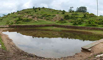
Direct lysimeters provide precise measurements but are expensive and not scalable, therefore the research utilizes three alternative methods: IMD station meteorological data, a network of 10 Class A evaporation pans distributed across rainfall zones, and SWAT/CFSR reanalysis data, all integrated into weekly, biweekly, and monthly ETo isohyets using GIS.
The ETo measurements from pans during 2016–17 were less than the long-term averages from SWAT, likely due to issues related to the siting in plain areas and errors from the initial setup, leading to the decision to use SWAT climatological data for budgeting as pan monitoring continues to enhance its quality and calibration.
The seasonal signal that drives scheduling
Long‑term SWAT ETo peaks in April–May at about 7.64–7.47 mm/day and dips in July–August at about 2.25–2.08 mm/day, providing a clear template for when irrigation intensity should rise or fall.
Monthly variability is modest (small standard deviations), so schedules anchored to monthly and weekly patterns are robust across years, with field‑level tuning for soil and rooting depth.
From climate signal to crop demand
Use the study’s KcKc tables to compute stage‑wise ETc from ETo for cereals, pulses, oilseeds, vegetables, fruit crops, and sugarcane, reflecting canopy development, height, surface roughness, and rooting.
Track performance with ETa and adjust irrigation using the FAO relation (1−Ya/Ym)=Ky (1−ETa/ETm)(1−Ya/Ym)=Ky(1−ETa/ETm), which links water deficit to expected yield loss, enabling realistic targets and trade‑off decisions.
Practical scheduling rules
- Increase frequency or depth during the April–May ETo peak and scale back during the July–August low to avoid non‑productive losses.
- Replace fixed turns with stage‑based turns using Kc so water tracks canopy growth and rooting rather than calendar dates.
- Protect critical stages (establishment, flowering, filling) to keep ETa close to ETc when yield sensitivity is highest, then taper as crops mature.
- Set application depth from weekly/fortnightly ETo combined with soil texture and effective rooting depth to limit percolation and runoff.
Field practices that cut losses
- Reduce bare‑soil evaporation using mulches or residue cover so a higher share of water goes into productive transpiration.
- Improve distribution uniformity with drip or well‑managed sprinklers and avoid irrigation during hot, windy hours when evaporation spikes.
- Match crop choice and variety with the ETo window and use stage lengths and Kc profiles to plan irrigation windows and harvest timing.
Basin‑scale planning with ET
Assign ETo to watersheds (from first to higher order) to build cascading water budgets that sum field needs into transparent, equitable allocations across micro‑zones.
Densifying rain and pan networks and continuing SWAT validation will reduce uncertainty and strengthen seasonal and intra‑seasonal planning for droughts and variable rainfall years.
Key takeaways
- Use weekly to monthly isohyets to plan irrigation intensity throughout the season, with ETo as the climatic driver.
- ETc transforms ETo to crop demand using stage-wise Kc, allowing for phenology-based scheduling instead of set turns.
- ETa verifies field performance, using the yield response relation to assess risk and lead remedial irrigation when gaps arise.